|
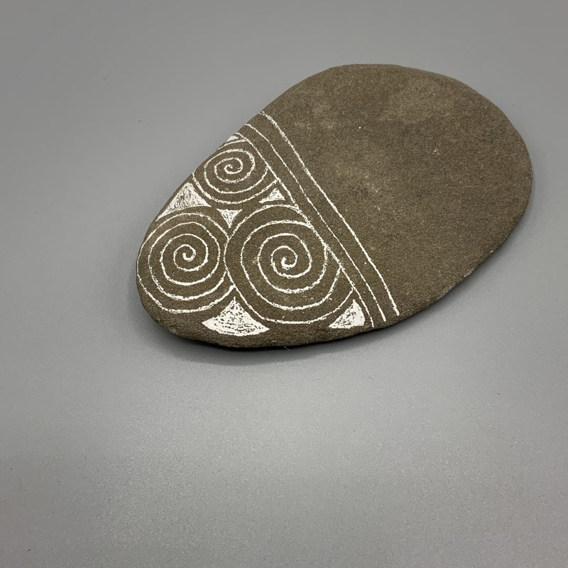
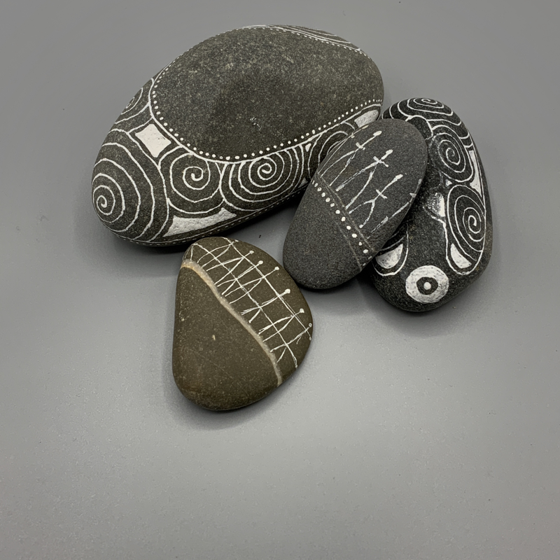
Great place to hang out on the solstice. Roughtin LInn such a special grouping of cup and rings.
0 Comments
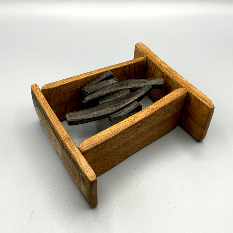
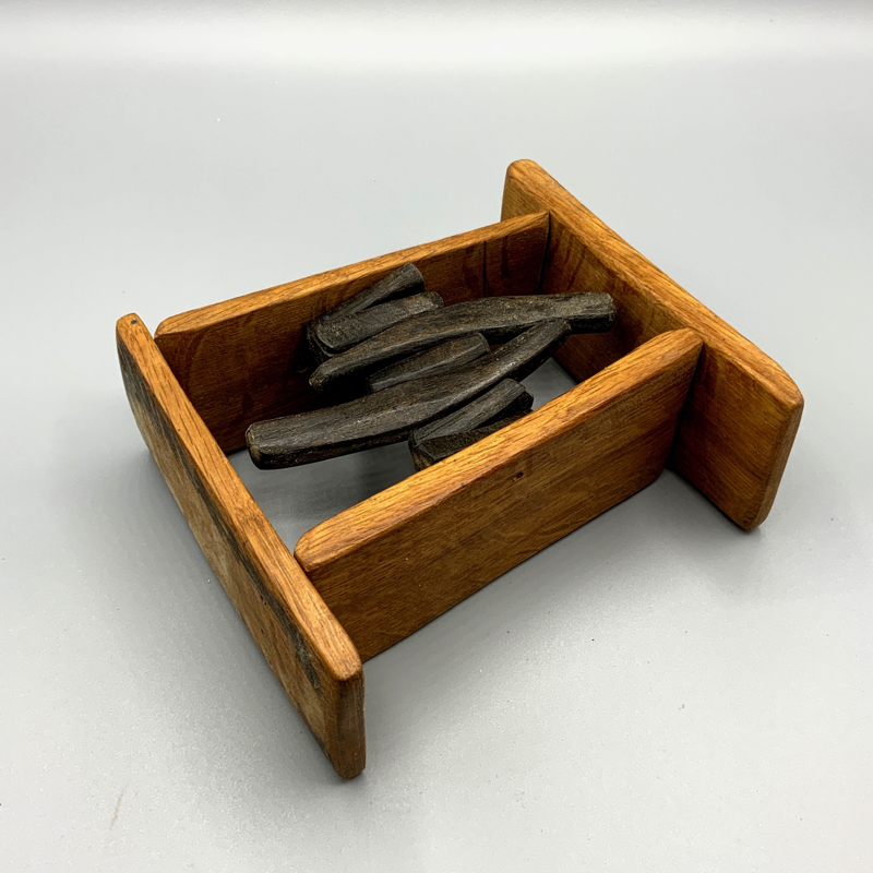
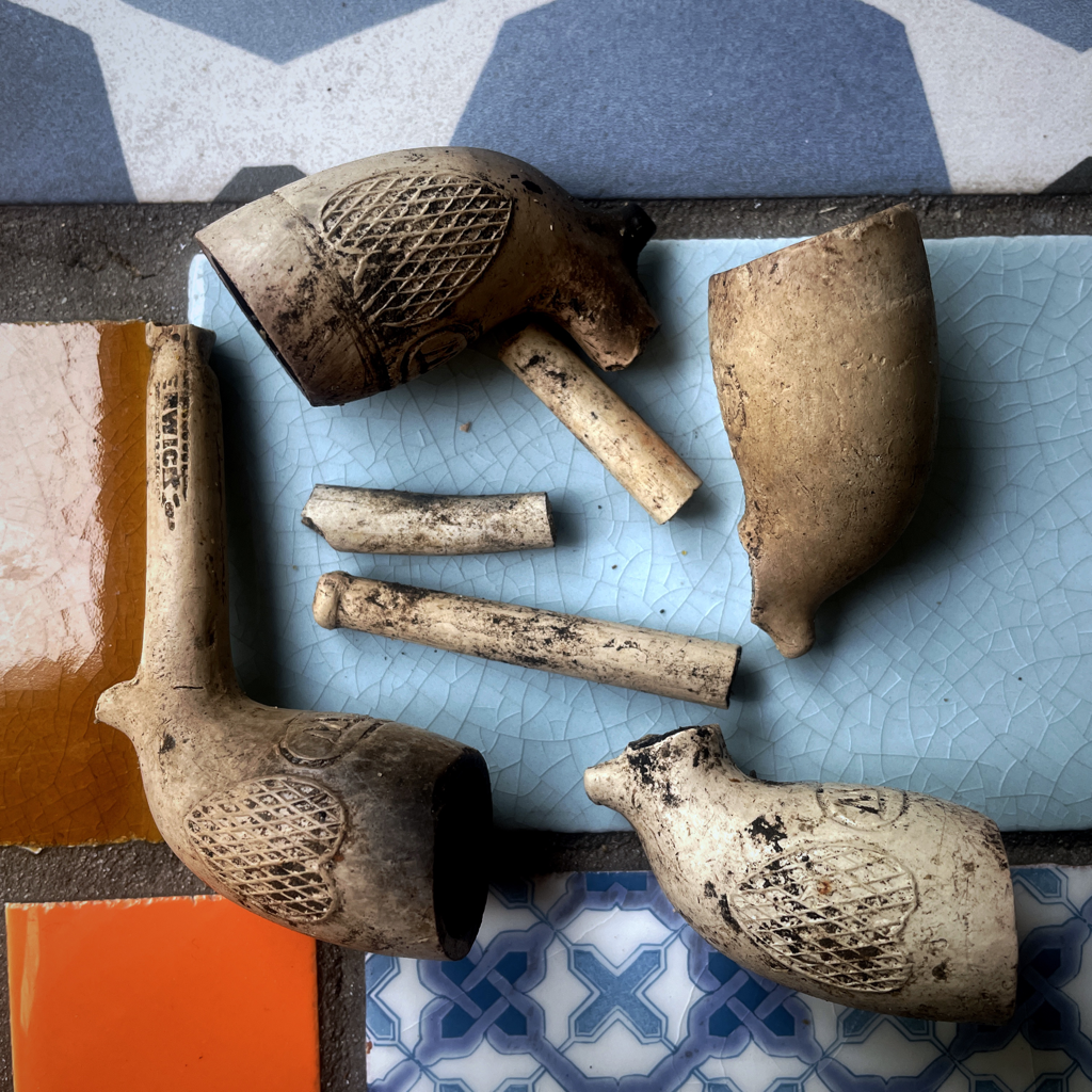 Four pipe bowls in sticking out the river bank after the snowmelt eroded a bit more of the old coup.
I've known the Ancrum area since 1976 when I first worked here in the Borders and the site of the prehistoric stone circle of Harestanes has always intrigued me. I have walked that field so many times since we took on the gallery and workshop space at Buy Design Gallery almost 30 years ago. - found nothing in that field whatsoever. It's commonly known as the Cricket Pitch field because this was the home turf of Lord Lothians team. Not sure when the matches ceased being played there. (1939 apparently) But the wooden pavilion still stands and the Dairy Cottage next door to the gallery was used to take tea. There is a beautiful oak panelled room with bay windows and small terrace looking out over the field.
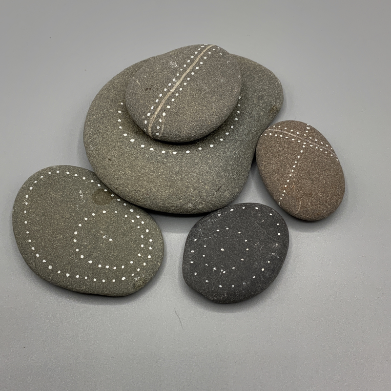
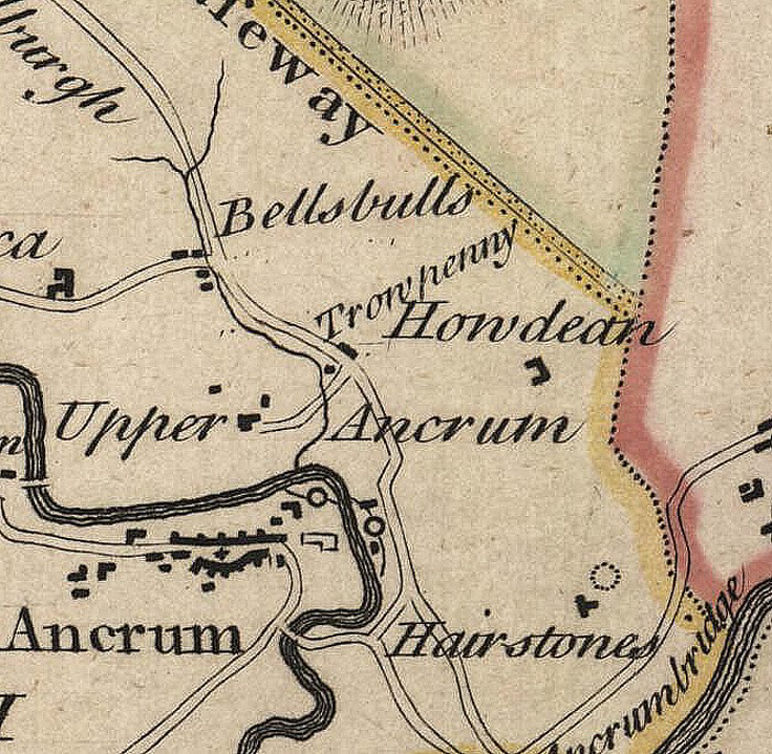
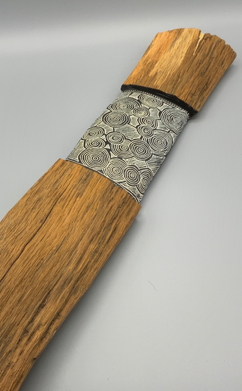
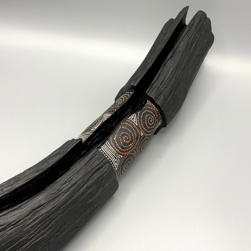
So Hairy Stanes, Holy Stones. Hairstones, word-shifted into Harestanes at some point. (there is another Harestanes circle near Blyth Bridge btw) Here's what I know (until someone comes up with some more welcome information that is !) Bleau’s map of 1662 shows an extra wee circle next to the medieval Spittal and Nunnery site which is next to Monteviot House. Could this be the first recorded image of the stone circle. ? Ainslie's beautifully drawn (and accurate) 1795 Ancrum Estate Map clearly shows the stone circle to the north and east of Harestanes farm steading. This seems to confirm the more conjectural location shown on Stobie's 1770 map of Roxburghshire. On Ainslie's Estate Map, the south-west portion of the stone circle (labelled 'Old City of Refuge a Druids Temple') coincides with a curvilinear enclosure dyke for the steading, and this appears to still have been extant by the time of the OS 1st Edtion 6" map. The circle is depicted as having 13-15 stones, with presumably others missing in a small woodland just inside the curvilinear dyke. The stone circle was removed in the intervening period between the 1795 map and the 1858 OS 1st Edition. On the balance of evidence, the location and shape of the circle shown on Ainslie's map may be accurate. This would place the hypothetical centre of the circle in the area of NT 6424 2449. The Scottish Royal Commission reported in 1947: "The stone circle that stood in the vicinity of Harestanes Cottages had been reduced to a single stone by 1845, (New Statistical Account [NSA] 1845) and this stone has since disappeared. No details of the circle are recorded and the evidence for its exact position is contradictory. Stobie's Map of Roxburghshire (1770) marks the site a little to the NE of Harestanes Cottages, while an estate map of 1795 is said to have placed it at the SW corner of this group of buildings. (G Watson 1908). RCAHMS 1956, visited 28 March 1947. This circle stood on mining ground, formerly known as 'Sillary Knowe', near Harestanes cottages. D Watson 1890. Enquiries at Harestanes Cottages proved negative. A 91 year old resident had never heard of the name "Sillery Knowe". Perambulation of the area found an alluvial ridge, planted with trees, at NT 643 243. Whether this could be the 'Knowe' in question, however, is conjectural; the position does not agree with Stobie's map or the 1795 estate map. Visited by OS (WDJ) 23 January 1967. 2019 was a good year for crop marks and Ancrum & District Heritage Society pal Richard Strathie flew his drone over the site. His image doesn't shown any definitive pits in a round or circular way that looks on first sight like a large stone circle. Pity - Richard and I were hoping for a classic 13/14 dark pit marks showing up. The drift geology and thin river washed soils make it difficult. It does however show up the straight line of the mil lade cut right across the "Cricket Pitch" field which fed the water to drive the overshot wheel which was sited at the home farm. So sometime around 1845 there was a single stone left. I'll put money on there being an early Victorian photographic image of people posing at the Hare Stane - anybody seen one ?. I've asked the Lothian Family archivist if there is such an image - not to his knowledge. It would really help to pinpoint the exact position of the circle. Ainslie J. (1795) Reduced Plan of the Estate of Ancrum Survey'd by John Ainslie 1795. NSA. (1834-1845) The new statistical account of Scotland by the ministers of the respective parishes under the superintendence of a committee of the society for the benefit of the sons and daughters of the clergy, 15v. Edinburgh. Page(s): Vol.3, (Roxburghshire), 244 RCAHMS Shelf Number: B.2.2.STA RCAHMS. (1956) The Royal Commission on the Ancient and Historical Monuments of Scotland. An inventory of the ancient and historical monuments of Roxburghshire: with the fourteenth report of the Commission, 2v. Edinburgh. Page(s): 60, no.22 RCAHMS Shelf Number: A.1.1.INV/14 Stobie, M. (1770) Map of Roxburghshire or Teviotdale, Scale 1"=1 mile. Watson, D. (1890) 'Ancient remains in Teviotdale- prehistoric, historical', 'The destruction of ancient monuments', Archaeol Rev, vol. 4, 1889-90. Page(s): 385 Watson, G. (1908) 'The stone circles of Roxburghshire', Trans Hawick Archaeol Soc, 1908. Page(s): 26 I’ve always had a fascination for indigenous art and so called primitive art. Since working in archaeology and timber I always wondered if the wood was painted in the houses, henges, chambered tombs, standing stones, rock art slabs and gathering sites here in Scotland. This is just a response to it all.
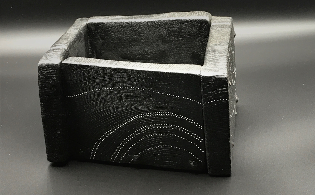
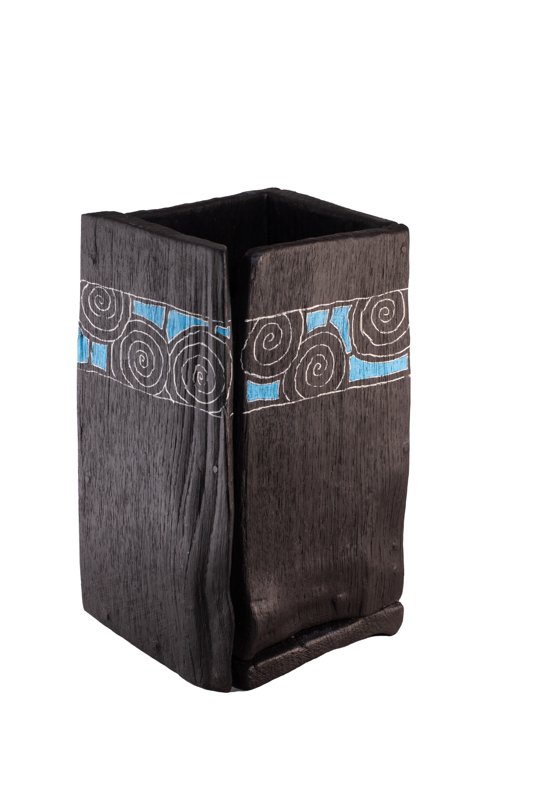
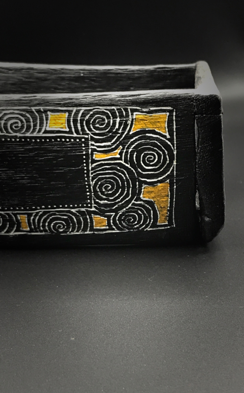
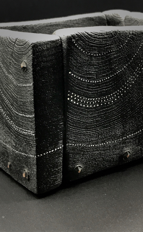
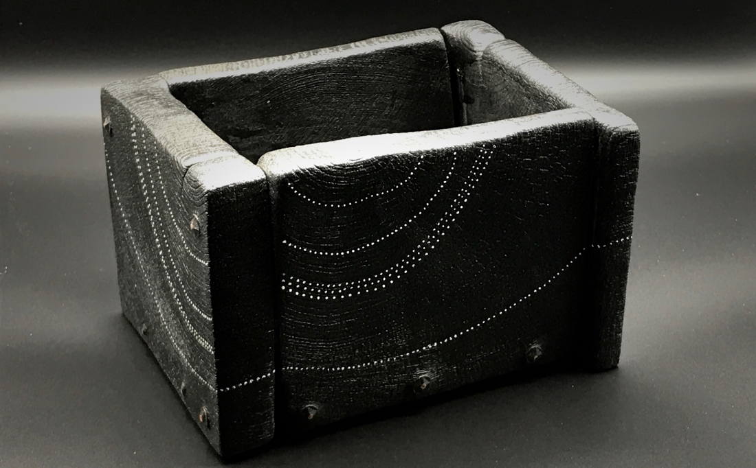
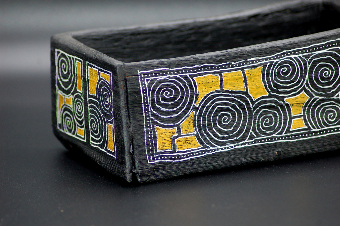
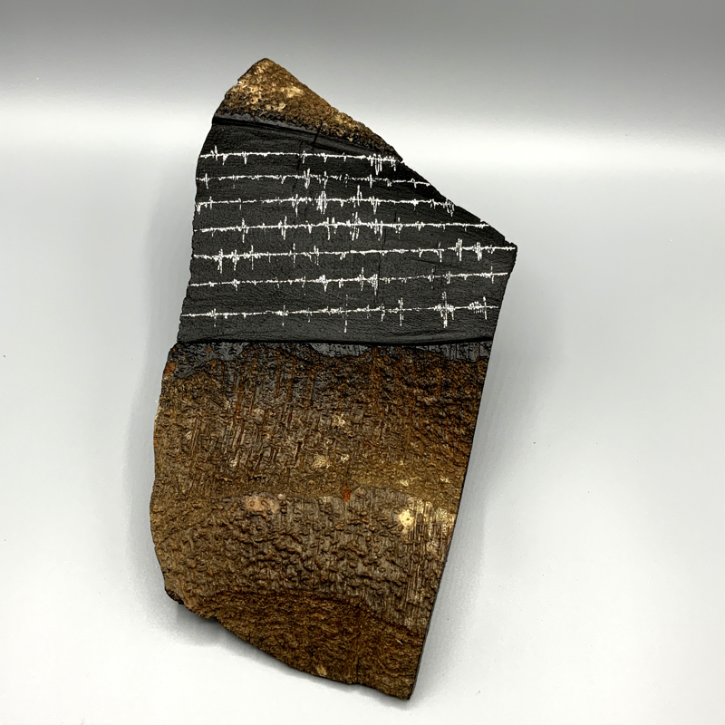
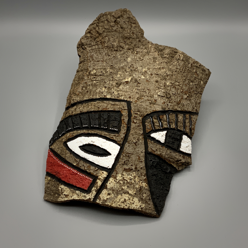
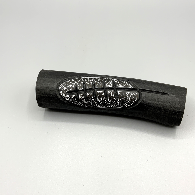
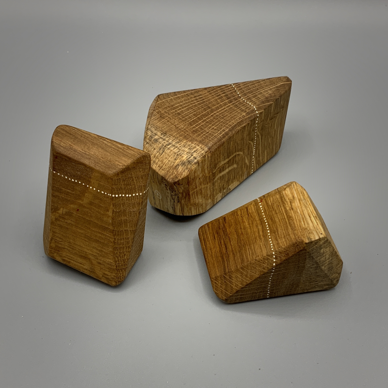
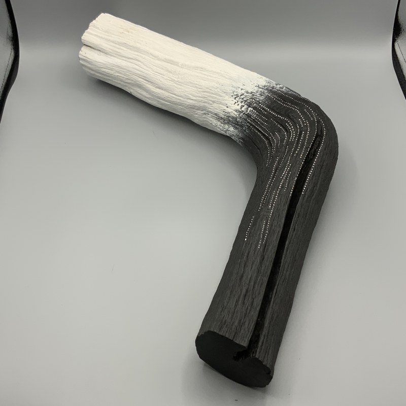
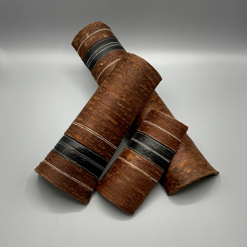
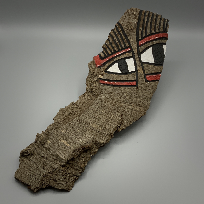
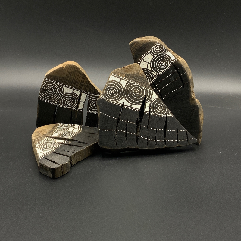
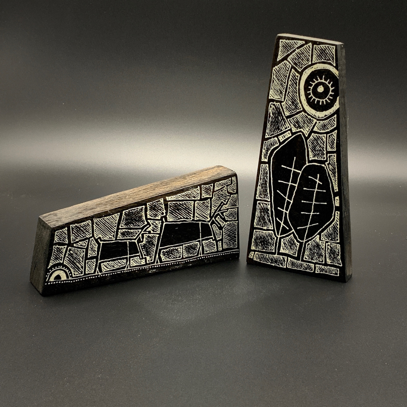
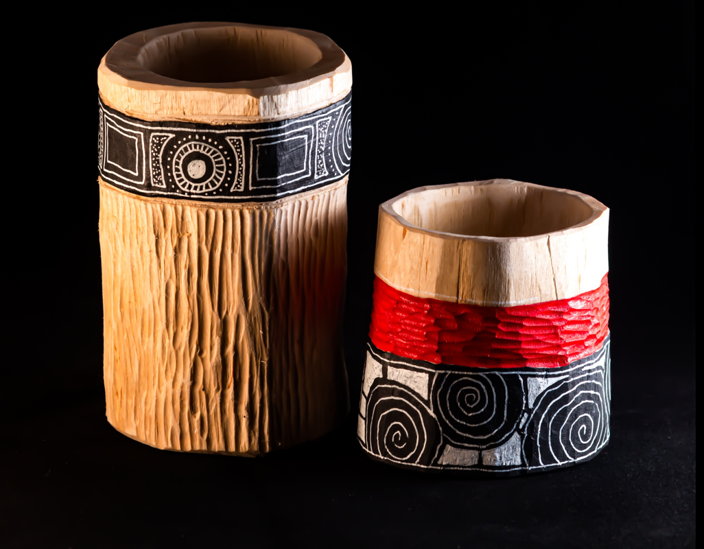
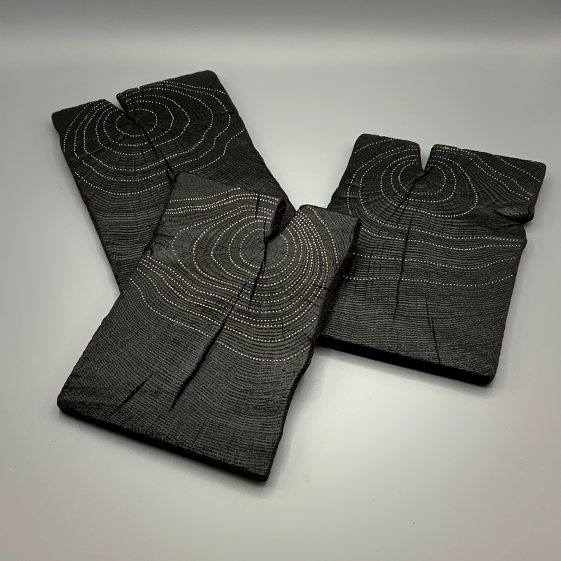
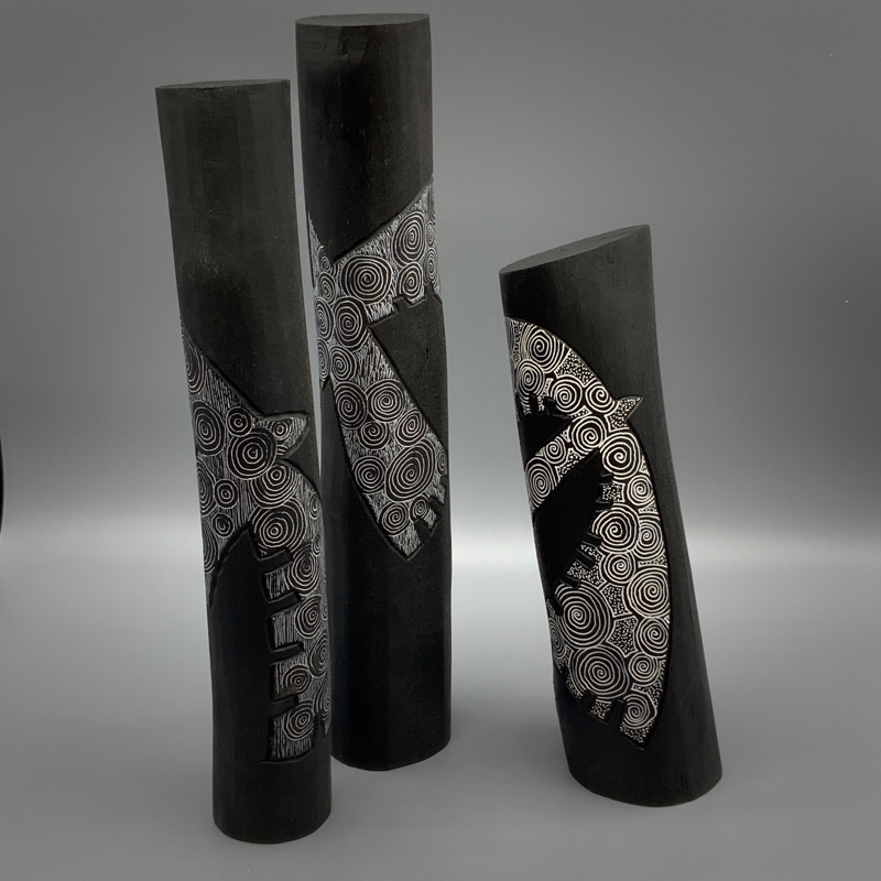
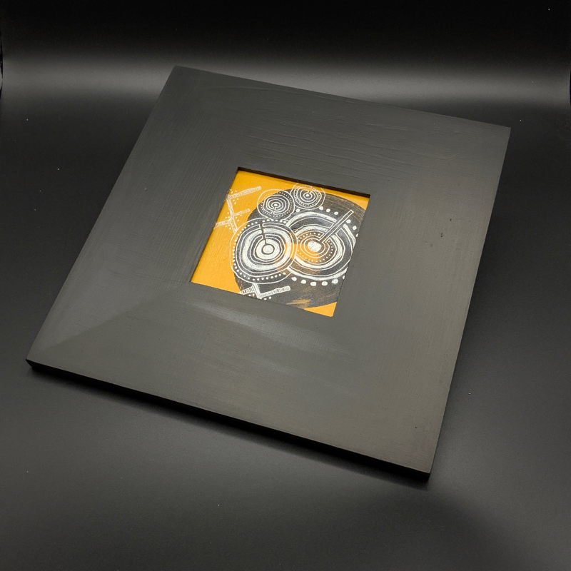
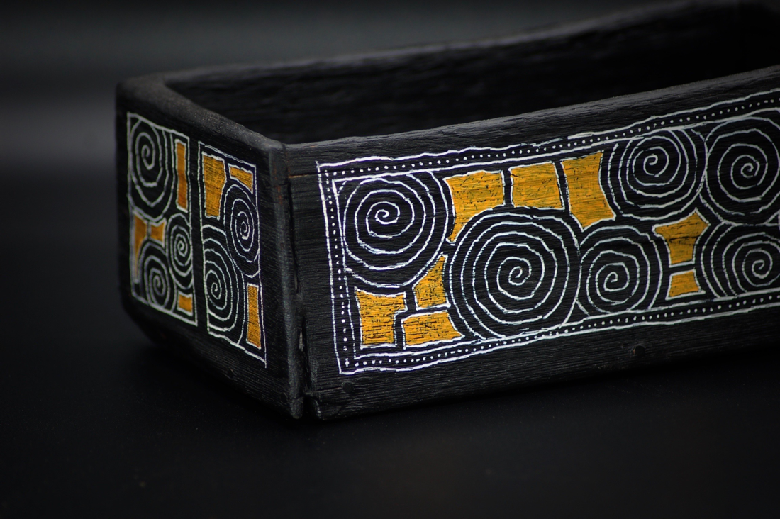
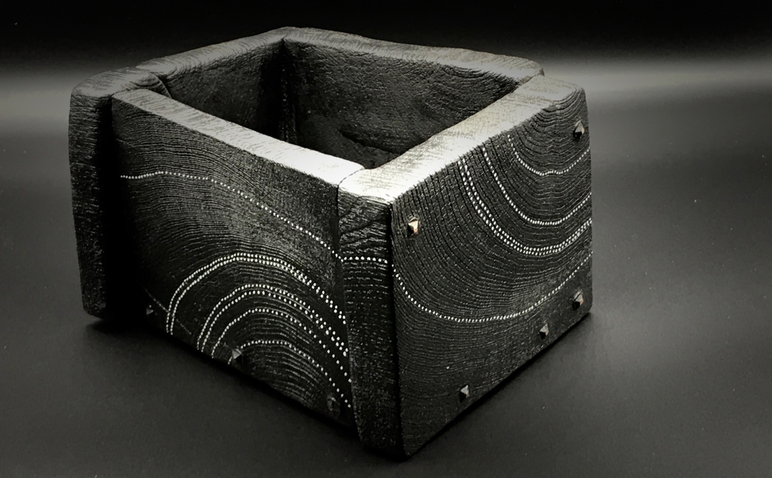
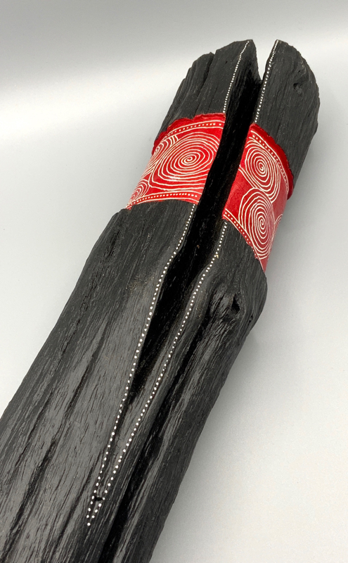
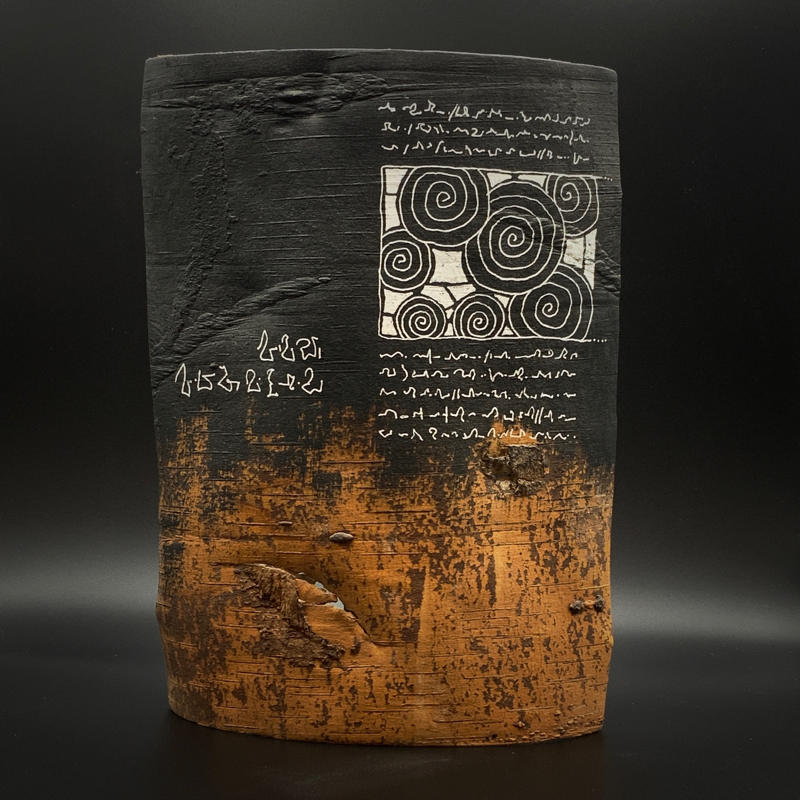
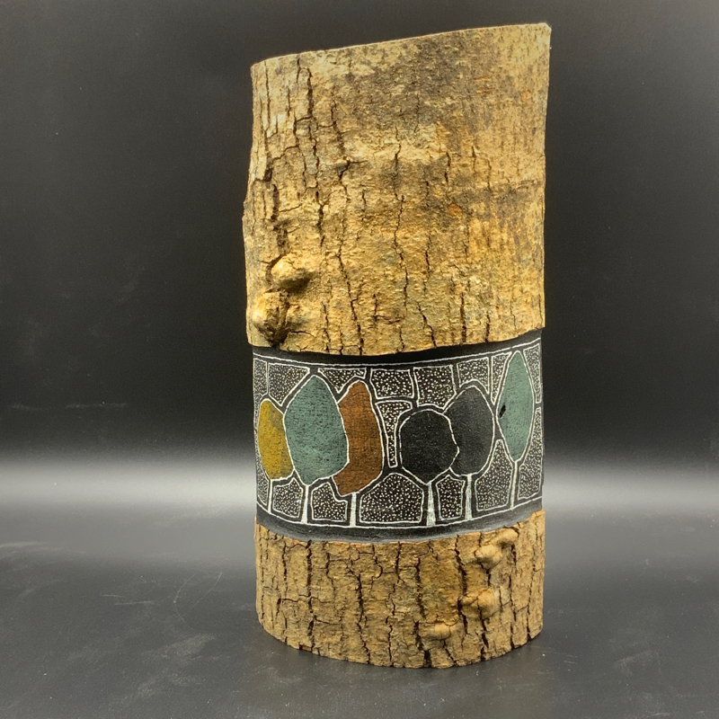
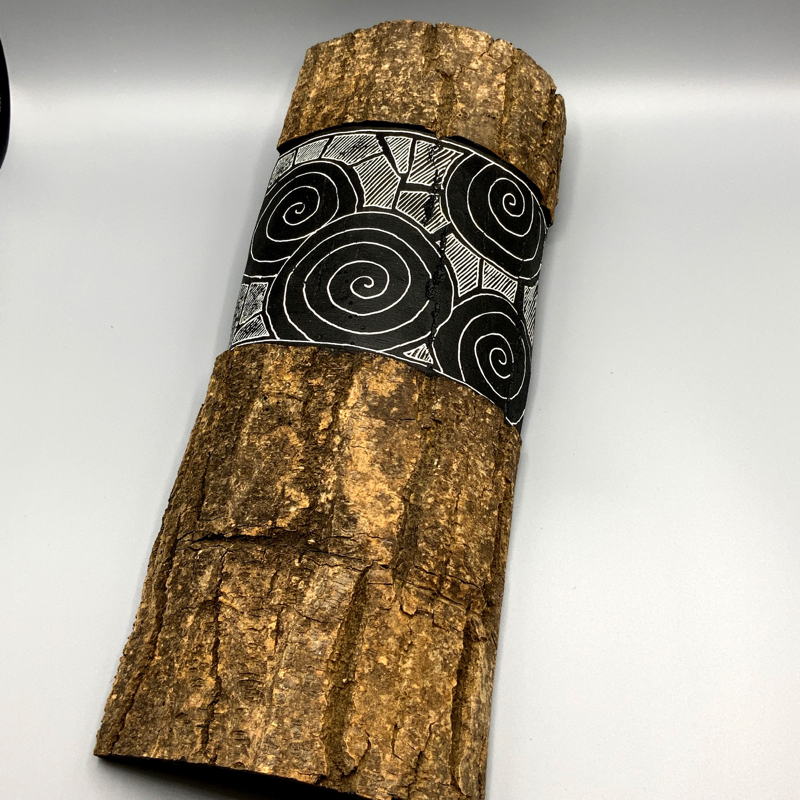
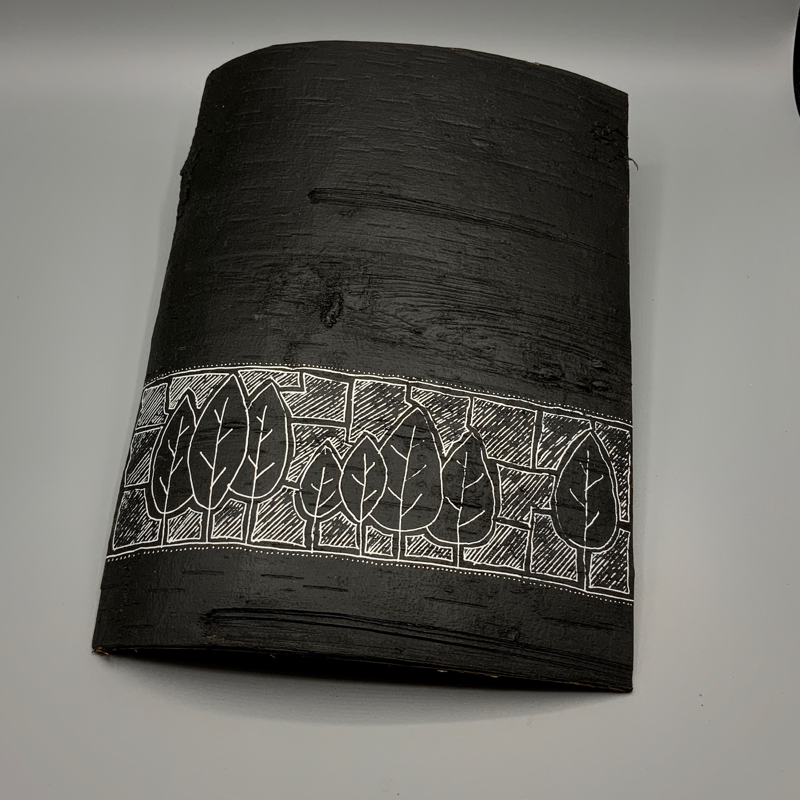
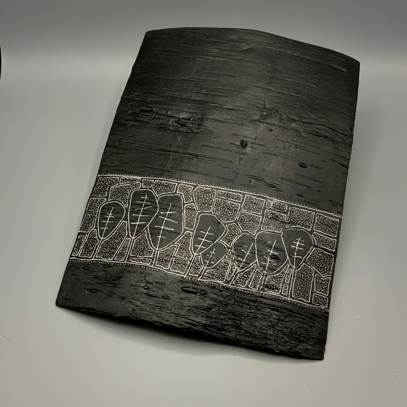
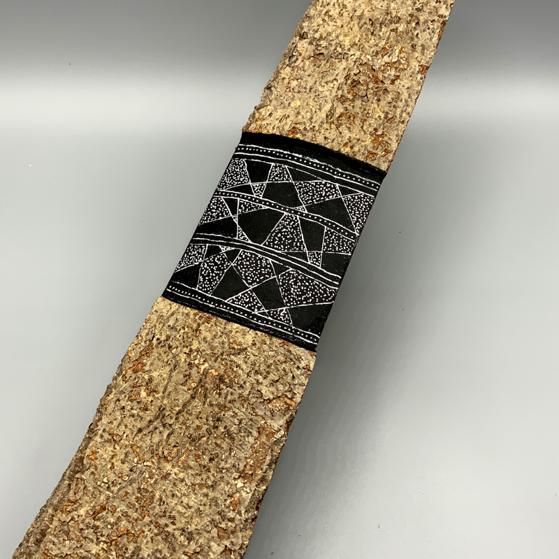
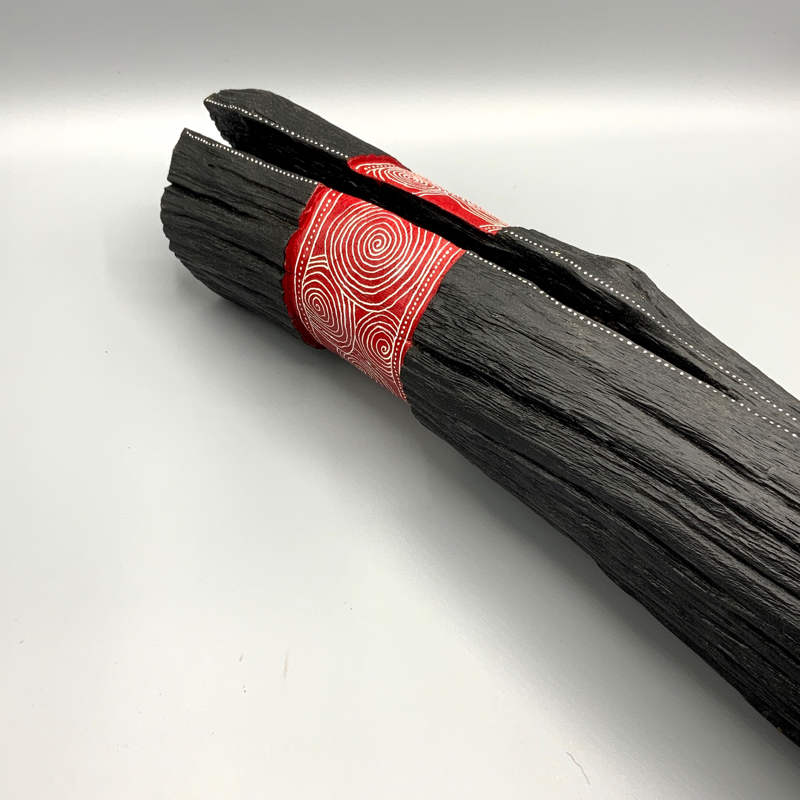
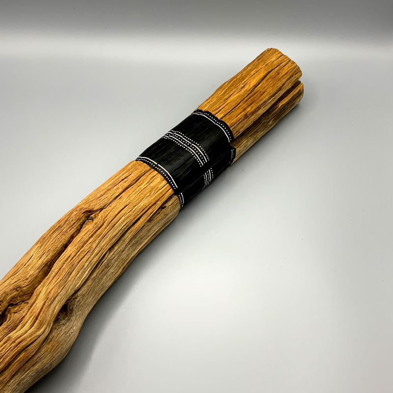
These wood tablets, bark sheets, stag oak branches and bog oak pieces are all painted on off-cuts from the workshop - ash, elm, oak, sycamore - whatever is lying around. All painted and carved tablets are made from Scottish hardwoods. They are storylines in themselves, partly mine, partly the viewer. Colourful, non descriptive, ancestral messages held on wood from a primitive place. I’ve put a series of new works up on The Big Tree Society website for sale. Have a look here I've always had a fascination for indigenous art and so called primitive art. Since working in archaeology and timber I always wondered if the wood was painted in the houses, henges and gathering sites here in Scotland. This is just a response to it all. These wood tablets, bark sheets, stag oak branches and bog oak pieces are all painted on offcuts from the workshop - ash, elm, oak, sycamore - whatever is lying around. All painted and carved tablets are made from Scottish hardwoods. They are storylines in themselves, partly mine, partly the viewer. Colourful, non descriptive, ancestral messages held on wood from a primitive place.
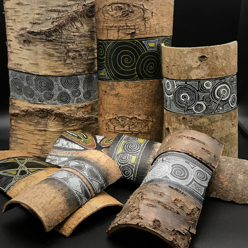
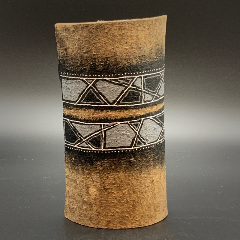
Some old a new work recently collated into one place. Mostly painted on ash, birch and alder bark from local Stromboli’s felled trees found along the River Tweed near Ancrum, Scottish Borders A few more to see here I've always had a fascination for indigenous art and so called primitive art. Since working in archaeology and timber I always wondered if the wood was painted in the houses, henges and gathering sites here in Scotland. This is just a response to it all. These wood tablets, bark sheets, stag oak branches and bog oak pieces are all painted on offcuts from the workshop - ash, elm, oak, sycamore - whatever is lying around. All painted and carved tablets are made from Scottish hardwoods. They are storylines in themselves, partly mine, partly the viewer. Colourful, non descriptive, ancestral messages held on wood from a primitive place. Some old a new work recently collated into one place. Mostly painted on stag oak branches found along the River Tweed near Ancrum, Scottish Borders A few more to see here. |